[email protected]
9779841365230
Trip Customization
Nepal Trekking
Everest Region
Everest Base Camp Trek
Everest Base Camp Luxury Heli Trek
Everest Base Camp Charity Yoga Trek
12 Days Everest Base Camp Short Trek
Everest High Passes Trek
Gokyo Chola Pass via EBC Trek
Gokyo Chola Pass Trek
Everest panorama View Trek
Gokyo Valley trek
Jiri to Everest base camp
Island Peak Climbing
Annapurna Region
Annapurna Base camp
Annapurna sanctuary
Poonhill Trek
Ghorepani Poon hill
Manaslu Circuit trek
Mardi Himal Trek
Tilicho Lake Trek
Charity Annapurna Yoga Trek
Langtang Region
Langtang Valley Trek
Tamang Heritage Trek
Langtang Ganja La Pass Trek
Gosainkunda Lake Trek
Langtang Gosainkunda Trek
Kanchenjunga Region
Kanchenjunga Circuit Trek
Kanchenjunga Base Camp
Other
Kathmandu Valley Rim Trek
Chisapani-Nagarkot Hiking
Chomolhari Trek
Rara Lake Trek
Lower Dolpo Trek
Guerrilla Trek
Nar Phu Trek
Badimalika Trek
Makalu Base Camp Trek
Panch Pokhari Trek
Upper Mustang Trek
Upper Dolpo Trek
Mountaineering
Mount Everest Expedition
Amadablam Expedition
Manaslu Expedition
Baruntse Expedition
Himlung Expedition
Churen Himal Expedition
Makalu Expedition
Cho Oyu Expedition
Peak Climbing
Island Peak Climbing
Mera Peak Climbing
Lobuche Peak Climbing
Chulu East Peak Climbing
Pisang Peak Climbing
Destination
Nepal
India
Bhutan
Tibet
Reviews
About
About Us
Company Information
Team Of Expertise
Legal Document
Payment Procedures
Terms And Conditions
Message From Founders
Blog
Contact
Account
Open main menu
Close menu
Nepal Trekking
Everest Region
Everest Base Camp Trek
Everest Base Camp Luxury Heli Trek
Everest Base Camp Charity Yoga Trek
12 Days Everest Base Camp Short Trek
Everest High Passes Trek
Gokyo Chola Pass via EBC Trek
Gokyo Chola Pass Trek
Everest panorama View Trek
Gokyo Valley trek
Jiri to Everest base camp
Island Peak Climbing
Annapurna Region
Annapurna Base camp
Annapurna sanctuary
Poonhill Trek
Ghorepani Poon hill
Manaslu Circuit trek
Mardi Himal Trek
Tilicho Lake Trek
Charity Annapurna Yoga Trek
Langtang Region
Langtang Valley Trek
Tamang Heritage Trek
Langtang Ganja La Pass Trek
Gosainkunda Lake Trek
Langtang Gosainkunda Trek
Kanchenjunga Region
Kanchenjunga Circuit Trek
Kanchenjunga Base Camp
Other
Kathmandu Valley Rim Trek
Chisapani-Nagarkot Hiking
Chomolhari Trek
Rara Lake Trek
Lower Dolpo Trek
Guerrilla Trek
Nar Phu Trek
Badimalika Trek
Makalu Base Camp Trek
Panch Pokhari Trek
Upper Mustang Trek
Upper Dolpo Trek
Mountaineering
Mount Everest Expedition
Amadablam Expedition
Manaslu Expedition
Baruntse Expedition
Himlung Expedition
Churen Himal Expedition
Makalu Expedition
Cho Oyu Expedition
Peak Climbing
Island Peak Climbing
Mera Peak Climbing
Lobuche Peak Climbing
Chulu East Peak Climbing
Pisang Peak Climbing
Destination
Nepal
India
Bhutan
Tibet
Reviews
About
About Us
Company Information
Team Of Expertise
Legal Document
Payment Procedures
Terms And Conditions
Message From Founders
Blog
Contact
Account
[email protected]
9779841365230
Trip Customization
Home
Blog
Trekking in Nepal in June
Trekking in Nepal
Trekking in Nepal in June
Written by:
Basu Panday
Published On Apr 16, 2025
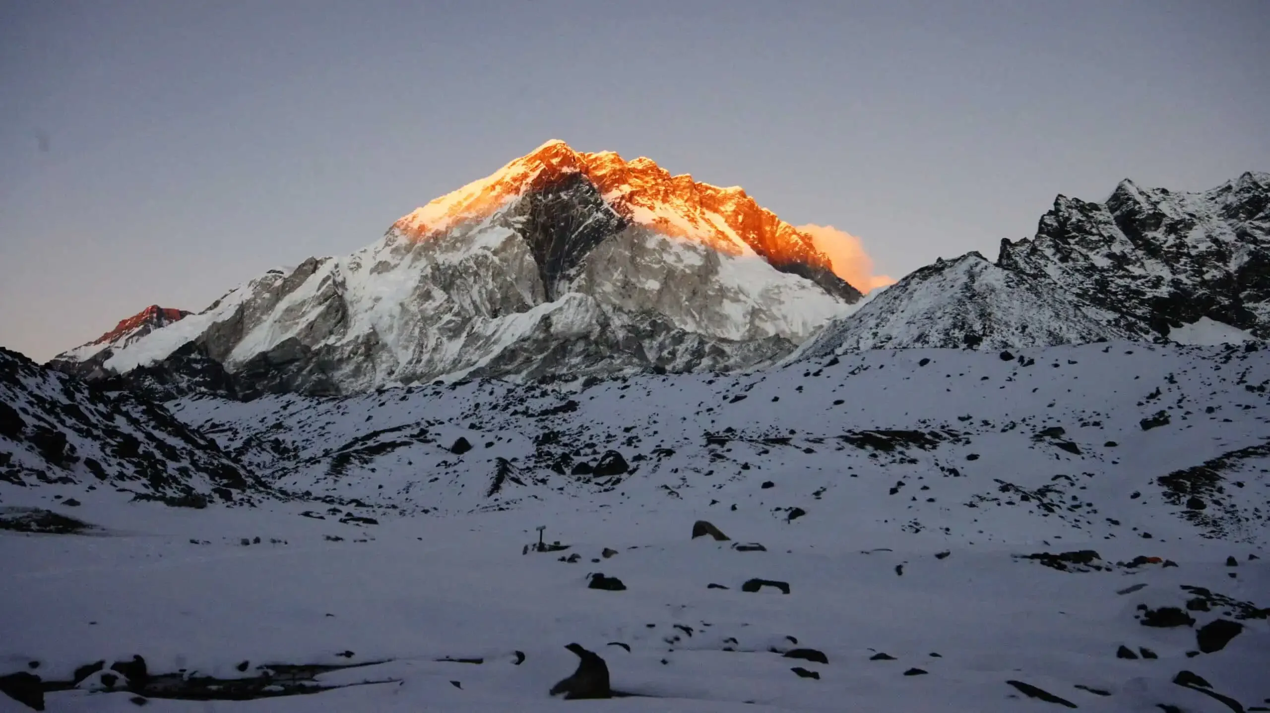
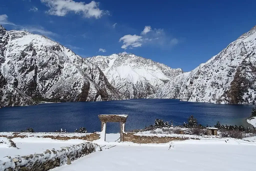
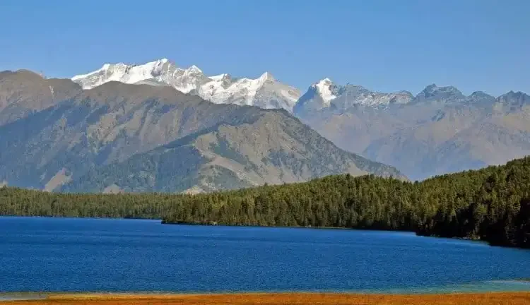
{"time":1744779844220,"blocks":[{"id":"BHBzZKAq3N","type":"paragraph","data":{"text":"Nepal has some of the world\u2019s highest Himalayas. Tucked behind these amazing mountain ranges are the best regions to trek to during Monsoon. "}},{"id":"K3naMpcFdq","type":"paragraph","data":{"text":"Trekking in Nepal in June has a set of uncanny features for you to explore during your journey. The lower regions are fresh green while the higher reaches are snowy white. The rain shadow regions are dry all year round and favorable for trekking."}},{"id":"cgFdykU7XD","type":"paragraph","data":{"text":"Even though the treks that don\u2019t fall in rain shadow areas like Everest Base Camp Trek may be a little tough to do because of the rain, if you are well prepared, there\u2019s no trek too difficult to do. "}},{"id":"aGtduD6VPb","type":"header","data":{"text":"Weather Conditions in Nepal in June","level":2}},{"id":"5X6p8JtyQj","type":"paragraph","data":{"text":"June falls in Monsoon. The rain shadow regions do not receive much rainfall even during the rainiest of seasons. The skies remain clear offering amazing views. "}},{"id":"3enTLWXtsz","type":"paragraph","data":{"text":"The temperatures will be ranging from 25 to 30\u00baC. While the daytime temperatures will average to 35\u00baC, the night time temperatures drop to around 35\u00baC. The temperatures may even drop to around 0 to 5\u00baC at higher altitudes."}},{"id":"FbxaqU3e7h","type":"paragraph","data":{"text":"However, the regions except the rain shadow region receive rainfall almost every day. The skies are mostly cloudy and the evenings are rainy. The mornings are clear but the weather keeps changing without being stable. The same is with the weather at high altitudes."}},{"id":"BsRJ8n2Rak","type":"paragraph","data":{"text":"Here\u2019s a table depicting the temperatures and precipitations of major locations in Nepal during June."}},{"id":"hcxQPfURor","type":"table","data":{"withHeadings":false,"stretched":false,"content":[["Location","Elevation (m)","Minimum temperature in June(\u00b0C)","Maximum temperature in June(\u00b0C)","Precipitation in June(mm)"],["Kathmandu","1,400","19.1","28.1","252"],["Pokhara","900","20.7","29.7","626"],["Biratnagar","80","25","32.6","340"]]}},{"id":"be8GNt3BXb","type":"header","data":{"text":"Festival in Nepal in June","level":2}},{"id":"MVZvBN1GjP","type":"header","data":{"text":"Rice Plantation Festival","level":3}},{"id":"lCGYNgkhIV","type":"paragraph","data":{"text":"The rice plantation festival falls on the 15th of Ashar that\u2019s usually in June. This is the first day of rice planting which is a vital crop for Nepal as it\u2019s an agricultural country. You can also partake in the fun and help the villages with planting rice. It is also a great opportunity to learn about Nepali people and their cultures."}},{"id":"mx0NYK4jlW","type":"header","data":{"text":"Best Routes for Trekking in Nepal in June","level":2}},{"id":"TO1fgmUr07","type":"header","data":{"text":"1. Everest Base Camp Trek","level":3}},{"id":"BLbWTSiwEN","type":"image","data":{"url":"https:\/\/app.tripcart.com\/storage\/dHZhb2FLb2RlTEVqN09tTGs3V2p5cGgrUnhIZGsxUjJQaWhZNzhIeU9wVT0\/Everest-Base-Camp-Trek.webp","caption":"Everest Base Camp Trek","alt":"","width":1024,"height":683,"withBorder":false,"withBackground":false,"stretched":false}},{"id":"CUaEpH6UnW","type":"paragraph","data":{"text":"Walking to the laps of the Everest is what the Everest Base Camp Trek signifies. Although the monsoon is not a trekking season in Nepal, you can trek to Everest Region with a few preparations beforehand. "}},{"id":"T2sBCXfOeJ","type":"paragraph","data":{"text":"Kala Patthar is the highest point in the trek at an elevation of 5,545 meters. If the weather favors, you can catch some of the best views of Mount Everest from this vantage point. You can also get mesmerizing views of surrounding mountain ranges of Lhotse, Cho-Oyu, and Ama Dablam."}},{"id":"NSGQMuhCPd","type":"paragraph","data":{"text":"When you\u2019re at the lower reaches of the Everest Region, the forests artistic with lush green vegetation and colorful blossoming flowers. You can enjoy the peculiarities of trekking to Everest Base Camp in June with rain gear and proper preparation."}},{"id":"lKa749I8VW","type":"paragraph","data":{"text":"While getting shelter against the rain during your trek, you can use that opportunity to learn about the history, culture, and lifestyle of the Sherpas at the Sherpa capital of Namche."}},{"id":"s6ljyfhY7C","type":"paragraph","data":{"text":"Here\u2019s a table with Temperature and Rainfall details for locations en-route the Everest Base Camp Trek."}},{"id":"XBcVSJpRaw","type":"table","data":{"withHeadings":false,"stretched":false,"content":[["Location","Elevation (meters)","Minimum Temperature in June(\u00b0C)","Maximum Temperature in June(\u00b0C)","Precipitation in June(mm)"],["Lukla","2,860","10","18.3","280"],["Namche","3,440","6","15.5","171"],["Tengboche","3,956","4.7","14.5","136"],["Dingboche","4,380","1.1","13.7","64"],["Gorak Shep","5,160","-1.7","10.8","37"],["Lobuche","4,930","-0.9","11.7","43"]]}},{"id":"vEUmZlIH7Y","type":"paragraph","data":{"text":"Highlights of this trek"}},{"id":"DWBDi8YCHp","type":"list","data":{"style":"unordered","items":[{"content":"Everest Base Camp at 5,380 meters","items":[]},{"content":"Tengboche Monastery, the biggest Buddhist monastery in the Khumbu region","items":[]},{"content":"Kala Patthar, the highest point in the trek at 5,545 meters","items":[]},{"content":"Namche, the Sherpa capital of the world","items":[]},{"content":"Splendid views of Mt Everest, Lhotse, Ama Dablam, Cho-Oyu, Nuptse among others","items":[]}]}},{"id":"8vZkHSqw72","type":"paragraph","data":{"text":"Outline Itinerary"}},{"id":"CX64gS0QzW","type":"table","data":{"withHeadings":false,"stretched":false,"content":[["Day","Itinerary","Altitude from (Meters)","Altitude to (Meters)","Trekking Time (Hours)","Trekking Distance (Kilometers)"],["1","Arrive in Kathmandu","-","1,400","-","-"],["2","Fly from Kathmandu to Luka, then trek to Phakding","1,400","2,651","3-4","9"],["3","Trek from Phakding to Namche","2,651","3,440","5-6","12"],["4","Acclimatize in Namche","3,440","3,440","-","-"],["5","Trek from Namche to Tengboche","3,440","3,956","5-6","10"],["6","Trek from Tengboche to Dingboche","3,956","4,380","5-6","12"],["7","Acclimatize in Dingboche","4,380","4,380","-","-"],["8","Trek from Dingboche to Lobuche","4,380","4,930","6-7","12"],["9","Trek from Lobuche to Gorakh Shep, then hike to EBC(5,380 meters) and back to Gorakh Shep","4,930","5,160","7-8","15"],["10","Hike to Kala Patthar(5,545 meters), then trek from Gorakh Shep to Periche","5,160","4,371","6-7","13"],["11","Trek from Periche to Namche","4,371","3,440","7-8","14"],["12","Trek from Namche to Lukla ","3,440","2,860","7-8","15"],["13","Fly from Lukla to Kathmandu","2,860","1,400","-","-"],["14","Departure from Kathmandu","1,400","-","-","-"]]}},{"id":"FZ78Oj9hSf","type":"header","data":{"text":"2. Nar Phu Valley Trek","level":3}},{"id":"218nfTt5tH","type":"image","data":{"url":"https:\/\/app.tripcart.com\/storage\/dHZhb2FLb2RlTEVqN09tTGs3V2p5cGgrUnhIZGsxUjJQaWhZNzhIeU9wVT0\/Nar-Phu-Valley-Trek.webp","caption":"Nar Phu Valley Trek","alt":"","width":1063,"height":598,"withBorder":false,"withBackground":false,"stretched":false}},{"id":"rm9g3sLF5I","type":"paragraph","data":{"text":"The Nar Phu Valley Trek is one of the best choices for trekking in Nepal in June. This trek takes you to the rain shadow regions of the Annapurna Massifs. The regions that you explore in the trek are sunny and dry throughout the year. The Nar Phu Valley Trek is favorable to do even in the rainiest of seasons."}},{"id":"LZzoErtCsK","type":"paragraph","data":{"text":"The Kang La Pass standing at an elevation of 5,240 meters is a high Himalayan pass that you cross in this trek. You can view panoramic views of the high Himalayas including Annapurna, Manaslu, Dhaulagiri, Himlung Himal, Gangapurna, and Tilicho Peak from the top of this high pass."}},{"id":"jMSVIQTToN","type":"paragraph","data":{"text":"The isolated villages of Nar and Phu and the inhabitants living here are highlights on their own. The ancient cultures and traditions that they still practice and the Tibetan influences in their lifestyles are things that will keep you wanting to spend more time together with them."}},{"id":"1UqSFnALru","type":"paragraph","data":{"text":"Here\u2019s a table with Temperature and Rainfall details for locations en-route the Nar Phu Valley Trek."}},{"id":"911GjwLPyM","type":"table","data":{"withHeadings":false,"stretched":false,"content":[["Location","Elevation (meters)","Minimum Temperature in June(\u00b0C)","Maximum Temperature in June(\u00b0C)","Precipitation in June(mm)"],["Kathmandu","1,400","19.1","28.1","252"],["Pokhara","900","20.7","29.7","626"],["Jagat","1,340","18.4","28.5","355"],["Jomsom","2,743","10.9","22","16"],["Manang","3,517","6.6","17.6","26"]]}},{"id":"yi7y7GH9Kl","type":"paragraph","data":{"text":"Highlights of this trek"}},{"id":"JSh3uwpqT8","type":"list","data":{"style":"unordered","items":[{"content":"Kang La Pass, a Himalayan pass at 5,240 meters altitude","items":[]},{"content":"Glistening views of Annapurna II, Manaslu, Dhaulagiri, Himlung Himal, Gangapurna, and Tilicho Peak","items":[]},{"content":"Exploration of a part of the Tibetan Plateau that extends down to Nepal","items":[]},{"content":"Getting chances to spot rare wildlife like snow leopard, Himalayan Tahr, and musk deer","items":[]},{"content":"Getting insights into the uninfluenced cultures and lifestyles of the people living in the isolated villages of Nar and Phu","items":[]}]}},{"id":"dJsKg5qxrd","type":"paragraph","data":{"text":"Outline Itinerary"}},{"id":"RFJjfUNt4l","type":"table","data":{"withHeadings":false,"stretched":false,"content":[["Day","Description","Altitude from (Meters)","Altitude to (Meters)","Trekking Duration"],["1","Drive from Kathmandu to Koto via Besisahar (820m)","1,400","2,600","8 hours"],["2","Trek from Koto to Meta","2,600","3,560","6-7 hours"],["3","Trek from Meta to Phu","3,560","4,080","6-7 hours"],["4","Acclimatization day at Phu","4,080","4,080","-"],["5","Trek from Phu to Nar Phedi","4,080","3,490","7 hours"],["6","Trek from Nar Phedi to Nar Village","3,490","4,110","3 hours"],["7","Trek from Nar Village to Ngawal via Kang La Pass (5,240m)","4,110","3,650","8 hours"],["8","Trek from Ngawal to Pisang (3,300m) and Drive to Besisahar","3,650","820","4 hours"],["9","Drive from Besisahar to Kathmandu","820","1,400","5-6 hours"]]}},{"id":"G7GN7hx51f","type":"header","data":{"text":"3. Annapurna Circuit Trek","level":3}},{"id":"dYUEmvOZPT","type":"image","data":{"url":"https:\/\/app.tripcart.com\/storage\/dHZhb2FLb2RlTEVqN09tTGs3V2p5cGgrUnhIZGsxUjJQaWhZNzhIeU9wVT0\/Annapurna-Circuit-Trek.webp","caption":"Annapurna Circuit Trek","alt":"","width":1063,"height":616,"withBorder":false,"withBackground":false,"stretched":false}},{"id":"2FOGNwe4sw","type":"paragraph","data":{"text":"The Annapurna Circuit Trek is a world popular trekking route that you can explore in June. Since most of the route falls in the rain shadow regions, this trek is a good candidate for your trekking adventure in Monsoon."}},{"id":"dPuL2epmHs","type":"paragraph","data":{"text":"Thorong La is the highest elevation that you reach in this trek. You get mind-blowing views of Dhaulagiri, Manaslu, and Annapurna from the top of this pass at 5,416 meters. "}},{"id":"s4jdUvRcPm","type":"paragraph","data":{"text":"The trek takes you to the Kali Gandaki Gorge, the deepest gorge in the world. Walking alongside the diverse landscapes, picturesque villages, high passes and amazing mountain views is how the Annapurna Circuit Trek can be described in a sentence."}},{"id":"NOONCZRDAC","type":"paragraph","data":{"text":"You get to visit Muktinath, a holy Hindu pilgrimage of very high significance. This Vishnu temple is situated at the foot of Thorong La mountain pass. Hindu and Buddhist devotees come to worship this temple from all over Nepal."}},{"id":"DlW9CCsLZf","type":"paragraph","data":{"text":"Here\u2019s a table with Temperature and Rainfall details for locations en-route the Annapurna Circuit Trek."}},{"id":"XKBfngRzBC","type":"table","data":{"withHeadings":false,"stretched":false,"content":[["Location","Elevation (meters)","Minimum Temperature in May(\u00b0C)","Maximum Temperature in May(\u00b0C)","Precipitation in May(mm)"],["Pokhara","900","20.7","29.7","626"],["Jagat","1,300","18.4","28.5","355"],["Dharapani","1,860","17.7","28","296"],["Manang","3,540","6.6","17.6","26"],["Marpha","2,670","10.9","21.9","18"],["Beni","830","20.3","30.6","289"]]}},{"id":"4YnbhqPjyc","type":"paragraph","data":{"text":"Highlights of Annapurna Circuit Trek"}},{"id":"fvJjnQPMf4","type":"list","data":{"style":"unordered","items":[{"content":"Thorong La Pass, one of the highest passes of Nepal at 5,416 meters","items":[]},{"content":"Muktinath, a holy Hindu pilgrimage ","items":[]},{"content":"Beautiful views of Dhaulagiri, Manaslu, and Annapurna","items":[]},{"content":"Kali Gandaki Gorge, the world\u2019s deepest gorge","items":[]},{"content":"Pokhara, one of the most popular tourist hubs in Nepal","items":[]},{"content":"Spectacular sunrise view with a 360-degree panorama of the mountains from Poon Hill","items":[]}]}},{"id":"3vsDBeYC3Q","type":"paragraph","data":{"text":"Outline Itinerary"}},{"id":"R3LwBM95nN","type":"table","data":{"withHeadings":false,"stretched":false,"content":[["Day","Description","Altitude from (Meters)","Altitude to (Meters)","Trekking Duration"],["1","Drive from Kathmandu to Khudi","1,400","800","8 hours"],["2","Trek from Khudi to Sirung","800","2,220","6-7 hours"],["3","Trek from Sirung to Jagat","2,220","1,300","6-7 hours"],["4","Trek from Jagat to Dharapani","1,300","1,860","7-8 hours"],["5","Trek from Dharapani to Chame","1,860","2,710","5-6 hours"],["6","Trek from Chame to Pisang","2,710","3,300","5-6 hours"],["7","Trek from Pisang to Manang","3,300","3,540","6-7 hours"],["8","Acclimatization Day at Manang","3,540","3,540","5 hours"],["9","Trek from Manang to Yak Kharka","3,540","4,110","3-4 hours"],["10","Trek from Yak Kharka to Thorong Phedi","4,110","4,600","3-4 hours"],["11","Trek from Thorong Phedi to Muktinath via Thorong La Pass (5,140m)","4,600","3,710","7-8 hours"],["12","Trek from Muktinath to Marpha","3,710","2,670","5-6 hours"],["13","Trek from Marpha to Kalopani","2,670","2,530","5-6 hours"],["14","Trek from Kalopani to Tatopani","2,530","1,200","6-7 hours"],["15","Trek from Tatopani to Ghorepani","1,200","2,850","6-7 hours"],["16","Trek to Nayapul (1,070m) via Poon Hill (3,210m) and Drive to Pokhara","2,850","900","7-8 hours"],["17","Drive from Pokhara to Kathmandu","900","1,400","6-7 hours"]]}},{"id":"SmklrMWAr1","type":"header","data":{"text":"4. Manaslu Circuit Trek","level":3}},{"id":"E8qxV8AUcv","type":"image","data":{"url":"https:\/\/app.tripcart.com\/storage\/dHZhb2FLb2RlTEVqN09tTGs3V2p5cGgrUnhIZGsxUjJQaWhZNzhIeU9wVT0\/Manaslu-Region.webp","caption":"Manaslu Region","alt":"","width":1024,"height":678,"withBorder":false,"withBackground":false,"stretched":false}},{"id":"uRjvyoQSKH","type":"paragraph","data":{"text":"Manaslu Circuit Trek is often regarded as a great alternative to the world popular Annapurna Circuit Trek. "}},{"id":"jFosyNQNvL","type":"paragraph","data":{"text":"This trek takes you via terraced farmlands of paddy, canyons of Budi Gandaki, isolated villages, ancient Buddhist monasteries, tranquil lakes, and high Himalayan passes. Larkya La is a challenging pass of 5,135 meters altitude that you have to cross during this trek. You get baffling views of high Himalayas from the top of this high pass."}},{"id":"NETtXxMJVI","type":"paragraph","data":{"text":"The Manaslu Conservation Area is home to over 2000 species of flowering plants, 110 birds, 33 mammals, and 3 species of reptiles. While roaming around the dense forests, you may even spot a few exotic wildlife like snow leopard, musk deer, and Himalayan tahr."}},{"id":"IriZ7nP9uA","type":"paragraph","data":{"text":"This circular trek around Manaslu is a favourable trek for trekking in June because most of the route lies in the rain shadow regions where it\u2019s sunny and dry all year long. "}},{"id":"gGsgtlXQOj","type":"paragraph","data":{"text":"Here\u2019s a table with Temperature and Rainfall details for locations en-route the Manaslu Circuit Trek."}},{"id":"CGu4TR1Tni","type":"table","data":{"withHeadings":false,"stretched":false,"content":[["Location","Elevation (meters)","Minimum Temperature in June(\u00b0C)","Maximum Temperature in June(\u00b0C)","Precipitation in June(mm)"],["Sama Gaun","3,530","6.4","17.4","36"],["Samdo","3,690","3.6","15","28"],["Besisahar","760","20.6","30.1","605"],["Jagat","1,340","18.4","28.5","355"],["Lho","2,957","8.1","18.8","48"]]}},{"id":"tz5LTJklny","type":"paragraph","data":{"text":"Highlights of this trek"}},{"id":"wYTcbEW2Vi","type":"list","data":{"style":"unordered","items":[{"content":"Floral and wildlife diversity of the Manaslu Conservation Area","items":[]},{"content":"Larkya La Pass, one of the highest passes in the world at an altitude of 5,167 meters","items":[]},{"content":"Ancient and uninfluenced Tibetan cultures and lifestyles","items":[]},{"content":"Marvelous views of Manaslu, Kanchenjunga, Himlung, Cheo Himal, among other high Himalayas","items":[]},{"content":"Exotic wildlife like Snow Leopard, Tahr (Mountain Goat), Agali (Blue Sheep), and Pika (highest living mammal) ","items":[]}]}},{"id":"O92pBj9U5s","type":"paragraph","data":{"text":"Outline Itinerary"}},{"id":"Nz5ue9C0mS","type":"table","data":{"withHeadings":false,"stretched":false,"content":[["Day","Itinerary","Altitude from (Meters)","Altitude to (Meters)","Trekking Duration (Hours)"],["1","Drive from Kathmandu to Soti Khola","1,400","700","-"],["2","Trek from Soti Khola to Maccha Khola","700","930","6"],["3","Trek from Maccha Khola to Jagat","930","1,340","7"],["4","Trek from Jagat to Deng","1,340","1,600","6"],["5","Trek from Deng to Namrung","1,600","2,630","6"],["6","Trek from Namrung to Lho","2,630","2,957","4"],["7","Trek from Lho to Sama Gaun","2,957","3,530","4"],["8","Acclimatize at Sama Gaun, Side trip to either Pungyen Gompa, Manaslu Base Camp or Birendra Tal","3,530","4,400","4"],["9","Trek from Sama Gaun to Samdo","4,400","3,865","4"],["10","Acclimatization Day - Side Trip to Tibetan Border","3,865","5,100","8"],["11","Trek from Samdo to Dharmasala","3,865","4,460","4"],["12","Trek from Dharmasala to Bimthang through Larkya La Pass","4,460","3,590","10"],["13","Trek from Bimthang to Tal","3,590","1,700","9"],["14","Trek from Tal to Tilije or Besi Sahar(760m), then drive to Kathmandu","1,700","1,400","3"]]}},{"id":"VMYW4nu0Ud","type":"header","data":{"text":"5. Upper Mustang Trek","level":3}},{"id":"jTYBCJW9ik","type":"image","data":{"url":"https:\/\/app.tripcart.com\/storage\/dHZhb2FLb2RlTEVqN09tTGs3V2p5cGgrUnhIZGsxUjJQaWhZNzhIeU9wVT0\/Kagbeni-Gateway-to-Upper-Mustang-Trekking-in-Annapurna-Region.webp","caption":"Kagbeni gateway","alt":"","width":672,"height":372,"withBorder":false,"withBackground":false,"stretched":false}},{"id":"nu0WZpmjc1","type":"paragraph","data":{"text":"The Upper Mustang Trek is a journey to the forbidden kingdom of Lo situated at Mustang. This region lies in the rain shadow region and remains parched throughout the year. This is also a reason why it is one of the perfect destinations to trek in June."}},{"id":"MOXGM8KiOm","type":"paragraph","data":{"text":"The journey starts from the deepest gorge, Kali Gandaki through rustic trans-Himalayan landscapes and several quaint villages. The people living in these villages practice ancient Tibetan cultures and lifestyles still uninfluenced by modern society. "}},{"id":"mH14Kle1oM","type":"paragraph","data":{"text":"The trails that you walk en-route the Upper Mustang Trek are ever so alluring. Many parts of the landscapes that you find are rarely walked and your trek will be quiet and clean. You are surrounded by mountain ranges of Dhaulagiri and Annapurna throughout the trek. "}},{"id":"Sa1S5j2YbN","type":"paragraph","data":{"text":"Lo Manthang is the highest elevation that you reach at 3,840 meters. It is the former capital of the Forbidden Kingdom of Mustang. It was restricted for foreign travelers to trek here until only around 15 years earlier. Even today, non-Nepali trekkers require a restricted area permit to trek to Upper Mustang."}},{"id":"iVpQG1Vn5I","type":"paragraph","data":{"text":"Here\u2019s a table with Temperature and Rainfall details for locations en-route the Upper Mustang Trek."}},{"id":"pIXVyhpWxR","type":"table","data":{"withHeadings":false,"stretched":false,"content":[["Location","Elevation (meters)","Minimum Temperature in June(\u00b0C)","Maximum Temperature in June(\u00b0C)","Precipitation in June(mm)"],["Jomsom","2,743","10.9","22","16"],["Kagbeni","2,804","10","21.2","17"],["Chele","3,050","9","20.4","17"],["Lo Manthang","3,840","5","17","19"]]}},{"id":"9YcdfDv6fJ","type":"paragraph","data":{"text":"Highlights of this trek"}},{"id":"GXRHP4sPLI","type":"list","data":{"style":"unordered","items":[{"content":"Magnificent views of snow-capped mountains, including Dhaulagiri, Nilgiri, Annapurna, and others.","items":[]},{"content":"Lo-Manthang and the Forbidden Kingdom of Lo","items":[]},{"content":"Kali Gandaki gorge, the deepest gorge in the world","items":[]},{"content":"Muktinath, a holy temple of Hindu and Buddhist","items":[]},{"content":"Secluded and pristine trekking trails","items":[]}]}},{"id":"7vzjMgD3DP","type":"paragraph","data":{"text":"Outline Itinerary"}},{"id":"4gy7WgqXBK","type":"table","data":{"withHeadings":false,"stretched":false,"content":[["Day","Itinerary","Altitude from (Meters)","Altitude to (Meters)","Trekking Duration (Hours)"],["1","Arrival in Kathmandu","-","1,400","-"],["2","Sightseeing in Kathmandu","1,400","1,400","-"],["3","Drive from Kathmandu to Pokhara","1,400","900","-"],["4","Fly from Pokhara to Jomsom, then trek to Kagbeni","900","2,810","3-4"],["5","Trek from Kagbeni to Chele","2,810","3,050","5-6"],["6","Trek from Chele to Syanbochen","3,050","3,475","6-7"],["7","Trek from Syanbochen to Ghami","3,475","3,520","5-6"],["8","Trek from Ghami to Tsarang","3,520","3,620","5-6"],["9","Trek from Tsarang to Lo-Manthang","3,620","3,840","3-4"],["10","Acclimatize at Lo-Manthang","3,840","3,840","4-5"],["11","Trek from Lo-Manthang to Drakmar","3,840","3,810","6-7"],["12","Trek from Drakmar to Ghiling","3,810","3,806","5-6"],["13","Trek from Ghiling to Chhuksang","3,806","3,050","5-6"],["14","Trek from Chhuksang to Jomsom","3,050","2,700","6-7"],["15","Fly from Jomsom to Pokhara","2,700","900","-"],["16","Drive from Pokhara to Kathmandu","900","1,400","-"],["17","Departure from Kathmandu","1,400","-","-"]]}},{"id":"81Z0B17eCa","type":"header","data":{"text":"6. Langtang Valley Trek","level":3}},{"id":"AuH3OwsLea","type":"image","data":{"url":"https:\/\/app.tripcart.com\/storage\/dHZhb2FLb2RlTEVqN09tTGs3V2p5cGgrUnhIZGsxUjJQaWhZNzhIeU9wVT0\/langtang-valley-trek.webp","caption":"langtang valley trekking","alt":"","width":681,"height":296,"withBorder":false,"withBackground":false,"stretched":false}},{"id":"NboUfTGDeM","type":"paragraph","data":{"text":"Langtang Valley Trek is a short and amazing trek north of Kathmandu. The trails are mostly surrounded by dense forests of the Langtang National Park and amazing views of mountains Dorje Lakpa, Langtang Ri and Langtang Lirung. "}},{"id":"OP6ulUWvMk","type":"paragraph","data":{"text":"Langtang Valley Trek starts from 1,460 meters at Syabrubesi and stretches to 4,984 meters at Tsergo Ri."}},{"id":"zJdlQNzCEV","type":"paragraph","data":{"text":"Here\u2019s a table with Temperature and Rainfall details for locations en-route the Langtang Valley Trek."}},{"id":"6Wj9JgRzOp","type":"table","data":{"withHeadings":false,"stretched":false,"content":[["Location","Elevation (meters)","Minimum Temperature in June(\u00b0C)","Maximum Temperature in June(\u00b0C)","Precipitation in June (mm)"],["Langtang","3,430","6.6","16.7","93"],["Kyanjin gompa","3,870","4.4","15.2","68"],["Lama Hotel","2,380","10.8","19.7","195"]]}},{"id":"dCyjY3eGwJ","type":"paragraph","data":{"text":"Highlights of this trek"}},{"id":"F0UXaKPTES","type":"list","data":{"style":"unordered","items":[{"content":"Tserko Ri, the highest viewpoint in the trek at 4,984 meters","items":[]},{"content":"Kyanjin Gompa, an ancient Buddhist Monastery","items":[]},{"content":"Langtang National Park, home to rich biodiversity","items":[]},{"content":"Langtang Village and the friendly residents","items":[]},{"content":"Tibetan-influenced cultures and lifestyles","items":[]}]}},{"id":"ZM48WP4wJu","type":"paragraph","data":{"text":"Outline Itinerary"}},{"id":"u3UunpP6oE","type":"table","data":{"withHeadings":false,"stretched":false,"content":[["Day","Itinerary","Altitude from (Meters)","Altitude to (Meters)","Trekking Duration (Hours)"],["1","Drive from Kathmandu to Syabrubesi","1,400","1,550","-"],["2","Trek from Syabrubesi to Lama Hotel","1,550","2,380","6"],["3","Trek from Lama Hotel to Mundu via Langtang village","2,380","3,430","6-7"],["4","Trek from Mundu to Kyanjin Gompa","3,430","3,870","3"],["5","Trek from Kyanjin Gompa to Tserko Ri","3,870","4,984","7-8"],["6","Trek from Tserko Ri to Lama Hotel","4,984","2,380","6-7"],["7","Trek from Lama Hotel to Syabrubesi","2,380","1,550","6-7"],["8","Drive from Syabrubesi to Kathmandu","1,550","1,400","-"]]}},{"id":"MytBaagLzr","type":"header","data":{"text":"7. Royal Trek","level":3}},{"id":"A4H1wchICt","type":"image","data":{"url":"https:\/\/app.tripcart.com\/storage\/dHZhb2FLb2RlTEVqN09tTGs3V2p5cGgrUnhIZGsxUjJQaWhZNzhIeU9wVT0\/Royal-Trek.webp","caption":"Royal Trek","alt":"","width":1063,"height":710,"withBorder":false,"withBackground":false,"stretched":false}},{"id":"LWKgRGP56M","type":"paragraph","data":{"text":"The Royal Trek, as the name suggests, was popularised by Prince Charles. This trek is a short and comfortable journey to the Annapurna Sanctuary. "}},{"id":"a4fSBT7L6n","type":"paragraph","data":{"text":"The routes are mostly dense subtropical forests of the Annapurna Conservation Area. During June, the rain renders the forests clean and green. Although the routes are wet and slippery, with a pair of waterproof trekking shoes and a raincoat, you can explore the delights offered by the monsoon in this trekking route."}},{"id":"pqSLbiL45P","type":"paragraph","data":{"text":"Pokhara, the starting and ending point of the trek is one of the tourist hubs of Nepal. This is a wonderful city with three beautiful lakes that you can explore if time permits."}},{"id":"DFNBSUZvtl","type":"paragraph","data":{"text":"Here\u2019s a table with Temperature and Rainfall details for locations en-route the Royal Trek."}},{"id":"MpDcOvVdBu","type":"table","data":{"withHeadings":false,"stretched":false,"content":[["Location","Elevation (meters)","Minimum Temperature in June(\u00b0C)","Maximum Temperature in June(\u00b0C)","Precipitation in June(mm)"],["Kathmandu","1,400","19.1","28.1","252"],["Pokhara","900","20.7","29.7","626"],["Kalikasthan","1,142","18.8","28.2","518"]]}},{"id":"aNFR87KZud","type":"paragraph","data":{"text":"Highlights of the trek"}},{"id":"GMFgW1Kp4h","type":"list","data":{"style":"unordered","items":[{"content":"Retracing the route walked by Prince Charles","items":[]},{"content":"Gratifying views of Annapurna, Dhaulagiri and Machhapuchhre ranges","items":[]},{"content":"Pokhara, the mesmerizing city of lakes ","items":[]},{"content":"Short and comfortable trek to the Annapurna Sanctuary","items":[]}]}},{"id":"R5wjTuDUpA","type":"paragraph","data":{"text":"Outline Itinerary"}},{"id":"Hg7BQCFqob","type":"table","data":{"withHeadings":false,"stretched":false,"content":[["Day","Itinerary","Altitude from (Meters)","Altitude to (Meters)","Trekking Duration (Hours)"],["1","Trek from Pokhara to Kalikasthan","900","1,370","4-5"],["2","Trek from Kalikasthan to Syaklung","1,370","1,760","5-6"],["3","Trek from Syaklung to Chisapani","1,760","1,550","5-6"],["4","Trek from Chisapani to Pokhara","1,550","900","1"]]}},{"id":"JVbfkJVVbU","type":"header","data":{"text":"Tips for Trekking in Nepal in June","level":2}},{"id":"za05fJGLP1","type":"header","data":{"text":"Don\u2019t forget rain gear.","level":3}},{"id":"peFSuxq9Tu","type":"paragraph","data":{"text":"While planning your trek for June. you must prepare rain protection gear because it\u2019s a monsoon month and it rains almost every day until you reach rain shadow regions. The outer wearables like shoes, jackets, and trousers need to be waterproof. You can use a raincoat to cover yourself in case of rainfall. "}},{"id":"kChYymhlL4","type":"paragraph","data":{"text":"You also need to protect your bag and all the things inside from the rain. You can use a rain cover to cover your trekking bags. You can also take extra precautions and keep items like documents, electric equipment, and clothes inside ziplock bags. "}},{"id":"nPibgqEfS4","type":"header","data":{"text":"Pack bug repellents","level":3}},{"id":"UuyN6KvLsW","type":"paragraph","data":{"text":"During June, the wet and muggy weather attracts a lot of annoying bugs like leeches, slugs, and mosquitoes. It may ruin your trekking experience. Pack bug repellents and ointments to protect yourself from these bugs."}},{"id":"AdKmywhOqP","type":"header","data":{"text":"Avoid long treks that don\u2019t fall in rain shadow regions","level":3}},{"id":"W8RZd02QHg","type":"paragraph","data":{"text":"Trekking in monsoon means a lot of rain. The trails will be wet and slippery. Heavy rain showers may also end up pausing your trek. So, it is better to avoid long treks that don\u2019t fall in rain shadow areas. "}},{"id":"KVhynw2D9A","type":"paragraph","data":{"text":"Instead go for treks to Upper Mustang, Manaslu, or Nar Phu. These locations do not receive rainfall throughout the year and are favorable for trekking."}},{"id":"hFqEj7QUJY","type":"header","data":{"text":"Carry sleeping bag","level":3}},{"id":"eEGCPUBvPA","type":"paragraph","data":{"text":"Carrying a four-season sleeping bag is very important while trekking. At high altitudes, the temperatures may even sometimes drop below zero degrees celsius at night. The cold may even be felt inside the walls of teahouses and hotels. "}},{"id":"cvVBieFteL","type":"paragraph","data":{"text":"So, it\u2019s a good idea to carry a warm sleeping bag to get a good night\u2019s sleep through those chilly nights."}},{"id":"rluBaTTThJ","type":"header","data":{"text":"Wear clothes made of high-wicking fabrics","level":3}},{"id":"exskadMjdt","type":"paragraph","data":{"text":"Clothes made out of polyester or merino wool have excellent wicking properties. These keep the moisture away from your body and keeps the body dry."}},{"id":"JhHihIdIuM","type":"paragraph","data":{"text":"Fabrics like cotton and jeans take longer to dry and keep the body cold. This may also result in common cold or hypothermia."}},{"id":"hrMrS3n15Z","type":"header","data":{"text":"Carry a trekking pole.","level":3}},{"id":"4TQB2YI9Be","type":"paragraph","data":{"text":"A trekking pole is a very helpful piece of equipment while trekking. It can help while climbing steep slopes and while descending as well. It may also prove to be quite useful to trek through wet and slippery trails during the month of June. "}},{"id":"LFh006SnxP","type":"header","data":{"text":"Conclusion","level":2}},{"id":"BvxzIKzG8o","type":"paragraph","data":{"text":"June is a perfect month to trek in the spectacular rain-shadow areas of Nepal. Uncharted trekking trails like Upper Mustang and Manaslu offer some of the best adventures for Trekking in Nepal in June."}},{"id":"9gNLCtm5oe","type":"paragraph","data":{"text":"Traveling in June comes with some benefits like comfortable accommodation choices, lush green vegetation, and quiet trails. You get to experience a completely different trekking adventure."}},{"id":"dUVO1CS0DW","type":"paragraph","data":{"text":"With a little preparation like raincoats, waterproof trekking shoes, and bug repellents, June is a fine month to trek in Nepal."}},{"id":"fUTAlHSJPN","type":"header","data":{"text":"FAQs","level":2}},{"id":"fgTehywJG8","type":"header","data":{"text":"1. What is the weather like in June?","level":3}},{"id":"hK4aw1HwL8","type":"paragraph","data":{"text":"June lies in the monsoon in Nepal. It rains almost every day in the lower regions. However, it doesn\u2019t rain in the rain-shadow areas. "}},{"id":"9aIgc47XAR","type":"paragraph","data":{"text":"The temperatures will be ranging from 25 to 30\u00baC. While the daytime temperatures will average to 35\u00baC, the night time temperatures drop to around 35\u00baC. The temperatures may even drop to around 0 to 5\u00baC at higher altitudes."}},{"id":"jsxvizG6EI","type":"header","data":{"text":"2. Are accommodations available during June?","level":3}},{"id":"Kc4cT7N8M7","type":"paragraph","data":{"text":"Yes. Accommodations are available en-route the treks mentioned above. Most trekking routes that do not lie in the rain shadow regions should be avoided. Because due to monsoon, these regions do not receive many travellers and therefore, the teahouses and hotels may stay closed. "}},{"id":"8TyafhVyrZ","type":"paragraph","data":{"text":"However, most of the routes mentioned above are rain shadow regions where the teahouses and hotels remain open even during monsoon. So you can get comfortable beds, delicious local foods, and squat toilets. Some teahouses offer WiFi services, but you may have to pay extra charges to use it."}},{"id":"58gT659glF","type":"header","data":{"text":"3. Do I need rain protection gear for trekking in June?","level":3}},{"id":"TfOVbqPysF","type":"paragraph","data":{"text":"Yes. You will need to pack some rain protection gear during June. Although the rain shadow regions do not receive much rainfall, the lower regions do receive rain almost every day. Pack raincoats and rain covers for your backpack. "}},{"id":"q514e5WzF8","type":"paragraph","data":{"text":"Also, pay extra attention to your documents and electronic devices. Putting them into a ziplock bag can help protect them from water damage."}},{"id":"2PhLCrRzkm","type":"header","data":{"text":"4. Do I need travel insurance for trekking in Nepal in June?","level":3}},{"id":"VatHupgr6p","type":"paragraph","data":{"text":"It is not compulsory to have travel insurance. However, since accidents don\u2019t occur with warnings, we recommend you get travel insurance. In the case of travel injuries, flight cancellations, or property loss, insurance can help pay the bills."}},{"id":"tfhw17LJCI","type":"header","data":{"text":"5. What to do if I suffer from altitude sickness?","level":3}},{"id":"lfEHQ0A4KD","type":"paragraph","data":{"text":"Be aware of the early symptoms of altitude sickness after you cross the elevation mark of 3,500 meters. Common symptoms include headache, fatigue, insomnia, shortness of breath, and nausea. "}},{"id":"4CHqPsZAZJ","type":"paragraph","data":{"text":"Trekking at a relatively slow and steady pace is the best preventive measure for altitude sickness. It is a bad idea to ascend to high altitudes within a short period of time."}},{"id":"vk0qlRDjVO","type":"paragraph","data":{"text":"In case you suffer from altitude sickness, you need to stop climbing any further immediately. Descend to lower altitudes, take plenty of rest, and continue the trek only if your condition has improved."}},{"id":"XGdwrUhv9I","type":"paragraph","data":{"text":"You can also take medicines like Diamox, which helps to treat altitude sickness. However, if the situation is so dire that your symptoms don\u2019t lessen even after taking Diamox, then you need to stop your trek. A trekking guide may contact for a helicopter rescue."}}],"version":"2.31.0-rc.7"}
Previous
Trekking in Nepal with Kids
Next
What to Wear in Nepal?
Related Posts
Trekking in Nepal
Trekking in Nepal in November
Read More
Trekking in Nepal
Trekking in Nepal in October
Read More
Trekking in Nepal
10 Easy Treks in Nepal
Read More
Share on Facebook
Share on Twitter
Share on Pinterest
Share on Linkedin
Share on Whatsapp
Share on Reddit
Share on Telegram
Share on Email
300 ? true : false" @click="scrollToTop" >